GIS Projects
Everything I do in GIS has started with my personal experience in the field, and figuring out how I can find new ways to make my work more efficient. Because of this, all my work is built to send maps to be used in the field, and for field users to collect data that compliments the maps. From planning, to execution to final reporting, this is a holistic overview of the site.
I specialize in GIS solutions of varying complexity. I enjoy with high-resolution spatial data analysis, environmental monitoring, and delivering intuitive visualizations for stakeholders. The goal is to collect better data and unpack it so better decision can be made.
Mapping
High Resolution Drone Maps
RGB (Visual Light) or Multispectral (Vegetation Health Maps)
Digital Elevation Models for Topographic Analysis
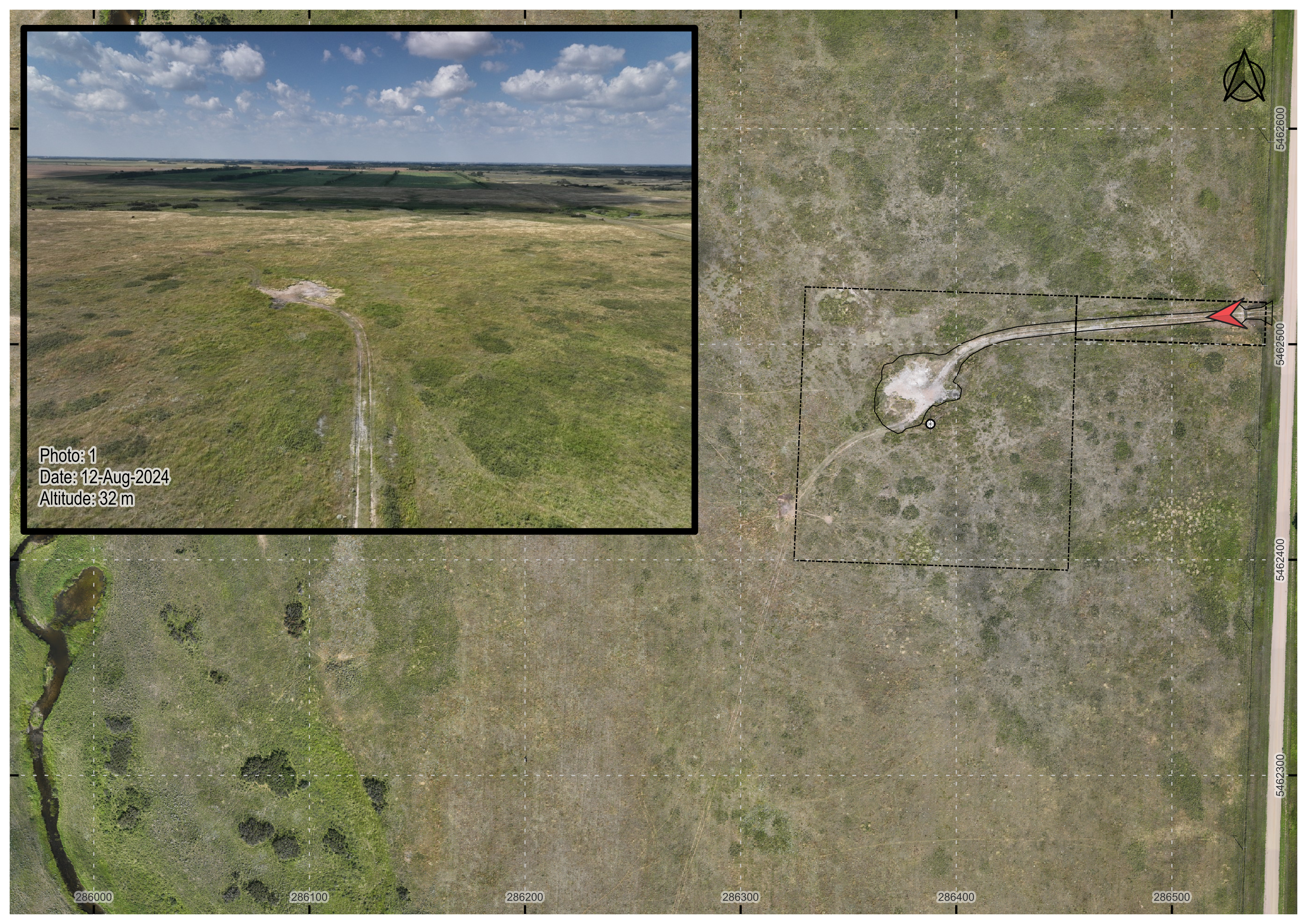
Combination Mapping / Photo Log
- Sync Drone Photo Location and Orientation Icon on Map with the Photo for an intuitive way to showcase your site
- Also works with SmartPhone Photos * (Need to collect proper photo EXIF information)
- Works great for crop scouting, large scale environmental site assessments, right of way assessments
- Custom Basemaps (drone maps, historic aerials, precision ag zones etc.) and Data Layers (survey boundaries, flowlines, well centres)
- Multiple map overviews
Right of Way Assessments
- Combination Drone Map with Photo Log
- Excellent for assessing ROWs to see if any residual crop damages
- Intuitive visuals make it easy to communicate with key stakeholders, landowners and regulators
High-Resolution Video inspections with custom telemetry overlays for reference
QGIS as the Link from Desktop to Field
Building a "Digital Twin"
- QGIS is a powerful solution that can combine survey boundaries, utility locates, boreholes, well centres etc, with basemaps for a geospatially accurate representation projects
- Add in complexity as needed:
- Drone maps
- Vegetation health
- Elevation models
- Soil conductivity maps (EM38, EM31)
- Groundwater Contours
- The desktop experience is only half the story, the real power of QGIS comes with interactive maps and data collection in the field. Although I learned all of this on Trimble Handsets, the future of field work is with MerginMaps.
- MerginMaps its built on the same opensource concepts as QGIS, and syncs beautifully with QGIS for a powerful way to interact with your maps and data in the field (https://merginmaps.com/)
Advanced Geospatial Analysis
My passion is in exploring new ways to collect and analyze geospatial data for a variety of applicaitons. From assessing vegetation health, mapping bare areas, monitoring crops over multiple years, searching for noxious weeds, or creating prescription maps for targeted spraying, there is a huge potential for geospatial data analysis.
Vegetation Health Analysis
- Multispectral data analysis
- Zonal Statistics (compare vegetation health between zones)
- Bare soil area calculations
- Vegetation vs Topography analysis
- Ultra High Resolution Plant Detection
- Experimental work measuring crop emergence
- Identify areas with poor emergence, flea beetle or cutworm damage
- Flowering analysis
Featured Project: Interactive NDVI Distribution Analysis Tool
This experimental project is ongoing, and demonstrates how I'm trying to handle two significant challenges in high resolution vegetation analysis:
- Statistical analysis of high-resolution multispectral maps where traditional significance tests become problematic due to extremely large sample sizes
- Quantifying field variability where conventional central tendency statistics fail to capture important localized variations in crop growth